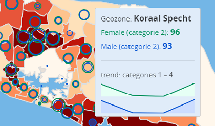
Curaçao Demography
This map provides some demography data of Curaçao. Demographic changes are described and illustrated in order to draw a comparative image of the population of Curaçao.

My Hometown
Curaçao is one of the most beautiful islands in the southern Caribbean, just before the Venezuelan coast. This Map show some private property and tourist attractions.
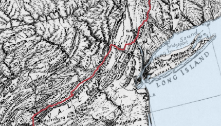
Appalachian Trail
This is a special commemorative map showing the Appalachian Trail, using a classic map from [Erwin Raisz].
Languages: HTML, CSS, JavaScriptApplications: QGIS, GitHUB
Datasources:
US Powerplants Map
This map give information about alternatives energy (Hydro , Solar and Biomass ) consumend in the United States. The data consist of 6900 electrical generating power plants across the US and contain the total generating capacity of each plant.
Languages: HTML, CSS, JavaScriptApplications: QGIS, Leaflet, GitHUB
Datasource: EIA's form 923
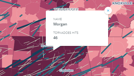
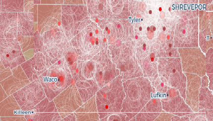
US Tornadoes 1950-2017
This Map is composed by counting the number of all tornadoes per county and categorized according to the "Fujita scale" (F0 - F5).
Languages: HTML, CSS, JavaScriptApplications: QGIS, CARTO, GitHUB
Datasource:
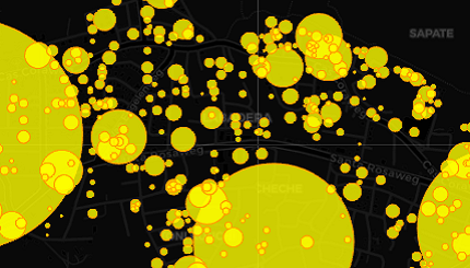
US Wildfires 2013
This Map shows different types of thematic symbol of all the wildfires in the US. First you see a choropleth map showing total acre burned per county. Second a graduated point symbol showing the individual wildfires size and thirt the date and place of the wildfire in 2013. .
Languages: HTML, CSS, JavaScriptApplications: QGIS, CARTO, GitHUB
Datasource:
Mortgages Map
This webmap provides an overview of the number of issued mortgages in the period from 1993 up to 2018.
Languages: HTML, CSS, JavaScriptApplications: QGIS, CARTO, GitHUB
Datasource: Stichting Kadaster en Openbare Registers Curaçao
(Land Registry Office.)